
Got a little explorer at home who’s always asking “Why?” or “Where is that?” An atlas isn’t just a book of maps; it’s a portal to discovery! If you’re searching for the best atlas for kids, you’ve come to the right place. We’ve scoured the globe (pun intended!) to bring you a hand-picked selection of top-notch children’s atlases that make learning geography fun and engaging. Get ready to embark on an armchair adventure with these fantastic resources!
These vibrant books are more than just collections of maps; they’re educational tools that spark curiosity, teach about different cultures, and help kids understand the vastness and diversity of our planet. Let’s dive into our top picks for the best atlases that will inspire young minds.
Why an Atlas is a Must-Have for Young Explorers
Before we unveil our top choices, let’s quickly chat about why an atlas is such a vital addition to any child’s library:
- Boosts Geographic Literacy: Helps kids understand locations, continents, countries, and oceans.
- Sparks Curiosity: Introduces them to different cultures, landmarks, and wildlife from around the world.
- Develops Spatial Reasoning: Enhances their ability to understand relationships between places.
- Supports Learning: An excellent resource for school projects, current events, and general knowledge.
- Encourages Independent Discovery: Kids can explore at their own pace, following their interests.
Ready to find the perfect world atlas for your little one? Let’s check out the contenders!
Our Top Picks for the Best Atlas for Kids
Here are our detailed reviews of the 7 best atlases for kids, designed to inform and inspire your choice:
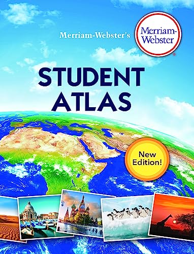
Merriam-Webster’s Student Atlas – Features Full-Color…

This student atlas from Merriam-Webster is a brilliant resource for older elementary and middle schoolers transitioning into more detailed geography. It balances vibrant maps with a wealth of information, making it ideal for homework, reports, and delving deeper into the world’s physical and political landscapes. It’s not just about naming places; it’s about understanding them.
Key Features:
– Comprehensive coverage of continents, countries, and regions
– Clear, full-color political and physical maps
– Includes thematic maps on climate, population, and resources
– Offers factual data, flags, and quick-reference statistics
– Sturdy binding designed for repeated use
Pros:
– Excellent for school-aged children needing detailed information
– Combines maps with charts, graphs, and geographical facts
– Reliable and authoritative content from Merriam-Webster
– Promotes a deeper understanding of world geography
Cons:
– May be too detailed or less visually stimulating for younger children
– Not as interactive as some other options
– Primarily a reference tool, less narrative-driven
User Impressions: Parents and educators praise this atlas for its academic rigor and accuracy. Many mention it’s a go-to resource for school projects, offering just the right level of detail without being overwhelming. Kids appreciate the clear layout once they’re ready for more in-depth study.
Call to Action: See it on Amazon here
Children’s Illustrated Atlas: Revised and Updated Edition

For younger adventurers, the Children’s Illustrated Atlas is a visual treat! This revised and updated edition combines beautiful illustrations with accessible information, making world geography engaging and easy to understand. It’s perfect for sparking early interest in different countries and cultures with its friendly, inviting design.
Key Features:
– Richly illustrated maps featuring iconic landmarks, animals, and cultural details
– Simple, easy-to-read text suitable for early readers
– Covers all continents and major countries
– Updated information ensures relevance
– Durable pages designed for little hands
Pros:
– Highly engaging and visually appealing for younger kids
– Introduces basic geography concepts in a fun way
– Encourages discovery with charming illustrations
– Great for reading aloud or independent exploration
Cons:
– Less detailed than atlases for older students
– Focuses more on highlights than comprehensive data
– Might be outgrown quickly as children seek more information
User Impressions: This atlas consistently receives rave reviews for its captivating illustrations and child-friendly approach. Parents love how it keeps their kids entertained while subtly teaching them about the world. It’s often cited as a favorite for family story time and imaginative play.
Call to Action: See it on Amazon here
National Geographic Kids United States Atlas, 7th Edition…

National Geographic is synonymous with exploration, and their Kids United States Atlas lives up to that reputation. This 7th edition is a fantastic resource specifically focused on the wonders of the USA. It’s packed with vibrant maps, cool facts, and incredible photos that bring each state to life, making it the best atlas for kids interested in their home country.
Key Features:
– Detailed, colorful maps of all 50 states
– Captivating photos of landscapes, landmarks, and wildlife
– Includes fascinating facts about each state’s history, culture, and geography
– Fun challenges, quizzes, and games to test knowledge
– Updated with current information and statistics
Pros:
– Super engaging content from a trusted source (National Geographic)
– Excellent for learning about U.S. states, capitals, and regions
– Combines education with entertainment
– High-quality production with durable pages
Cons:
– Limited to the United States, so not a world atlas
– Some might prefer more political detail over fun facts
– Could feel a bit overwhelming with the amount of visual information
User Impressions: A true hit with kids and parents alike! Users frequently highlight the stunning photography and the engaging way National Geographic presents information. It’s highly recommended for road trips, homeschooling, and anyone wanting to dive deep into American geography.
Call to Action: See it on Amazon here
National Geographic Kids World Atlas, 6th Edition (NGK…

If your child’s curiosity extends beyond the U.S. borders, the National Geographic Kids World Atlas is an absolute must-have. This 6th edition provides a comprehensive tour of the entire planet, using Nat Geo’s signature blend of stunning photography, easy-to-understand maps, and intriguing facts. It’s a perfect global companion for young explorers.
Key Features:
– Detailed maps of every continent and major country
– Features iconic photos of natural wonders, cities, and cultures
– Includes interesting facts about demographics, environments, and landmarks
– Special sections on world records, explorations, and global issues
– Large format for easy viewing and engagement
Pros:
– Trusted content from National Geographic, ensuring accuracy and quality
– Extremely visually stimulating and engaging for children
– Broad global coverage, perfect for general world geography
– Encourages an appreciation for global diversity and environmental awareness
Cons:
– Might be too broad for kids looking for in-depth detail on specific regions
– Can be a bit pricey compared to simpler atlases
– The amount of information might overwhelm very young readers
User Impressions: This atlas is consistently praised for its “wow” factor. Children are captivated by the incredible photos and the accessible way complex information is presented. It’s a favorite for bedtime reading and spontaneous discoveries, fostering a lifelong love for learning about the world.
Call to Action: See it on Amazon here
Lonely Planet Kids Lift-the-Flap Atlas

Lonely Planet, a giant in travel guides, brings its expertise to kids with this wonderfully interactive Lift-the-Flap Atlas. Designed to delight younger children, this atlas transforms learning into a game. Each flap reveals hidden facts and details about different regions, making exploration a hands-on adventure.
Key Features:
– Over 80 flaps to lift and discover hidden information
– Colorful, illustrated maps showcasing continents and countries
– Focuses on unique animals, landmarks, and cultural elements
– Durable board book format suitable for little hands
– Encourages active engagement and discovery
Pros:
– Highly interactive and engaging, perfect for toddlers and preschoolers
– Makes learning geography feel like a fun game
– Introduces early map-reading skills in a playful way
– Robust construction holds up well to enthusiastic use
Cons:
– Very basic geographical detail; not for older kids seeking in-depth knowledge
– Can be outgrown quickly as children age
– Flaps might tear if handled too roughly over time
User Impressions: Parents absolutely adore the interactive element, noting how it holds young children’s attention for extended periods. It’s often recommended as a first atlas, sparking curiosity and providing a joyful introduction to the world’s geography.
Call to Action: See it on Amazon here
Indescribable Atlas Adventures: An Explorer’s Guide to…

For families looking for an atlas with an inspiring, wonder-filled approach, Indescribable Atlas Adventures is a unique choice. This explorer’s guide goes beyond just maps, weaving in fascinating stories and facts that highlight the majesty and diversity of our planet from a perspective of awe and wonder. It’s truly an adventure in every sense!
Key Features:
– Blends geographical information with inspiring narrative and facts
– Explores natural wonders, unique ecosystems, and human achievements
– Engaging illustrations and photography
– Encourages appreciation for creation and discovery
– Designed to spark curiosity and wonder about the world
Pros:
– Offers a fresh, narrative-driven approach to geography
– Highly engaging for kids who love stories and big ideas
– Promotes a sense of wonder and appreciation for the planet
– A great option for family discussions and shared learning
Cons:
– May not be a traditional comprehensive atlas for detailed map reading
– Thematic focus might not suit those looking for pure geographical data
– Less emphasis on political boundaries and capitals
User Impressions: Reviewers appreciate the unique blend of science, geography, and inspirational content. Many families find it perfect for supplementing traditional learning, offering a broader, more wonder-filled perspective on the world. It’s often described as captivating and thought-provoking.
Call to Action: See it on Amazon here
World Geography Activity Book for Kids Ages 8-12:…

While not a traditional bound atlas in the same vein as the others, this World Geography Activity Book is a fantastic interactive companion for learning about the globe. It transforms geographical facts into engaging puzzles, quizzes, and hands-on activities, making it an excellent supplementary resource for kids aged 8-12 who thrive on doing. It’s the best atlas for kids who learn by interacting!
Key Features:
– Packed with puzzles, mazes, word searches, and coloring pages
– Covers continents, countries, capitals, landmarks, and cultures
– Provides opportunities for hands-on learning and skill development
– Engaging and educational content designed for active minds
– Reinforces geographical knowledge in a fun, non-traditional way
Pros:
– Highly interactive and keeps kids actively engaged
– Great for reinforcing learned geography concepts
– Perfect for travel, quiet time, or homeschooling supplemental activities
– Encourages problem-solving and critical thinking skills
Cons:
– Not a traditional reference atlas with detailed maps
– Requires other resources for comprehensive geographical information
– Some activities might be repetitive for certain children
User Impressions: This activity book receives high praise for making geography fun and approachable. Parents love that their kids are learning without even realizing it, and many find it invaluable for keeping children occupied and educated during long trips or quiet afternoons.
Call to Action: See it on Amazon here
How to Choose the Best Atlas for Your Child
With so many great options, choosing the best atlas for kids might seem tricky. Here are a few tips to help you narrow it down:
-
Consider Their Age and Developmental Stage:
- Toddlers/Preschoolers: Look for lift-the-flap, heavily illustrated, or basic board books.
- Elementary (Early): Simple maps, lots of pictures, fun facts, and engaging stories.
- Elementary (Late)/Middle School: More detailed maps, statistical data, thematic content, and comprehensive coverage.
-
Think About Their Interests:
- Do they love animals? Seek atlases that highlight wildlife.
- Are they fascinated by specific countries or their home nation? Choose a regional atlas.
- Do they enjoy hands-on activities? An activity book might be a better fit.
-
Visual Style: Some kids respond better to realistic maps, while others thrive on whimsical illustrations. National Geographic excels at detailed photography, while others offer cartoonish charm.
-
Purpose: Is it for quick reference, in-depth study, casual browsing, or travel entertainment? This will guide your choice between a comprehensive atlas and an activity book.
-
Durability: For younger children, look for sturdy covers and thick pages that can withstand enthusiastic handling.
Frequently Asked Questions (FAQ) About Kids’ Atlases
Q1: What age is suitable for a child’s atlas?
A: Atlases are available for almost all ages! Board book and lift-the-flap atlases are great for toddlers (2-5). Illustrated atlases with simple facts suit early elementary kids (5-8). More detailed student atlases are perfect for late elementary and middle schoolers (8-12+).
Q2: What’s the difference between an atlas and a globe?
A: An atlas is a collection of maps in book form, offering detailed views of regions, countries, or specific themes. A globe is a spherical model of the Earth, showing its true shape and relative distances accurately, but usually with less detail than an atlas page. Both are excellent tools for learning geography!
Q3: Are interactive atlases, like lift-the-flap versions, better for learning?
A: Interactive atlases are fantastic for engaging younger children and those who learn best by doing. The tactile experience of lifting flaps or solving puzzles can make learning memorable and fun. However, for older kids needing comprehensive data, a traditional, detailed atlas is usually more appropriate.
Q4: How can an atlas help with homeschooling or school projects?
A: Atlases are invaluable for homeschooling! They provide context for history lessons, help understand current events, locate settings for literature, and serve as primary resources for geography projects. They make abstract concepts concrete and visually engaging.
Q5: What features should I look for in a good atlas for kids?
A: Look for clear, colorful maps, age-appropriate text, engaging illustrations or photographs, interesting facts, and durable pages. For older kids, consider additional features like thematic maps (climate, population), flags, and statistical data.
Q6: How can I make learning with an atlas more fun and engaging for my child?
A:
* Play “I Spy”: Find countries, landmarks, or animals.
* Plan a “Dream Trip”: Use the atlas to plot a route and learn about destinations.
* Connect to Stories: Locate where a favorite book or movie is set.
* Trace & Draw: Have them trace maps or draw their own versions.
* Follow Current Events: Find countries mentioned in the news.
Q7: Is a physical atlas still relevant in the digital age?
A: Absolutely! While digital maps are convenient, a physical atlas offers a unique, tangible learning experience. It allows for browsing without distractions, encourages critical thinking by comparing different maps, and helps develop spatial awareness in a way screens often can’t replicate. Plus, there’s a certain magic to flipping through pages and discovering the world by hand!
Conclusion
Choosing the best atlas for kids is about more than just buying a book of maps; it’s about opening up a world of discovery, fostering curiosity, and building a foundation for global understanding. Whether your child is a budding cartographer, an animal enthusiast, or simply curious about “what’s out there,” there’s an atlas on this list that’s perfect for them.
No matter which you choose, investing in a quality atlas is an investment in their curiosity and global understanding. So go ahead, pick one of these amazing atlases, and watch your child’s world expand right from the comfort of your home!